
Here's some more self-made diagrams I whipped up using Google Maps images and Irfanview photo editing of this weekends shooting.
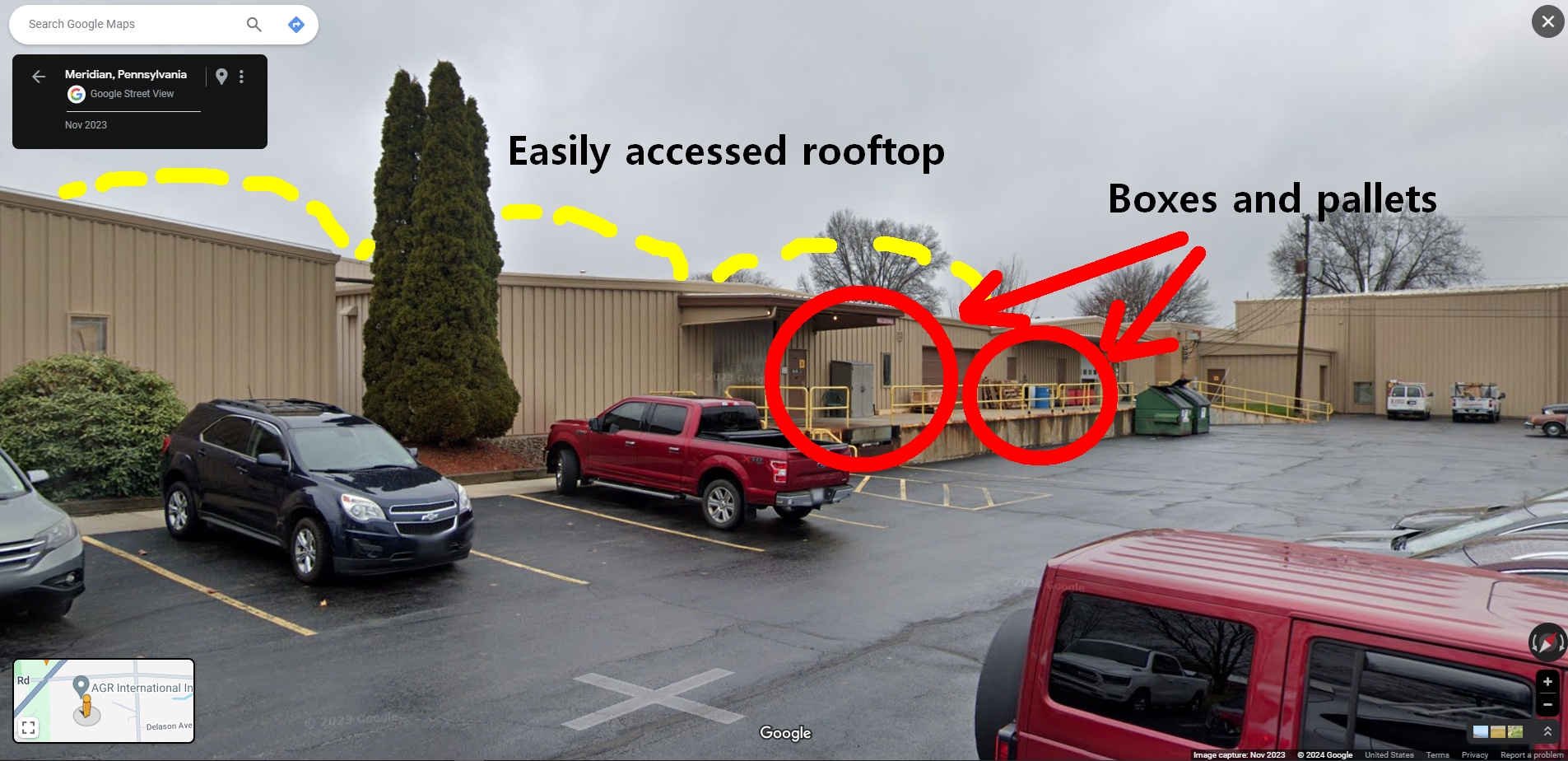
In my previous post on this, I wasn't sure how the shooter might have accessed the roof. Here we see objects that could easily be stacked, Half-Life style, to build make-shift steps to the roof. And have you seen the picture of this shooter? He's no doubt played plenty of FPS video games like Half-Life in his day.

News media is saying that local police and the Secret Service checked out the surroundings but as you can see clearly even from the parking lot you can see how prone Trump's position was to the rooftop of this building. How on Earth did they miss this?

From the same relative position in the parking lot as the photo above, turning 90° to the left, you see this big ass water tower fully accessible by a long ladder going up to this catwalk circumnavigating the big ball at the top. Why the heck wasn't a Secret Service sharpshooter up here? They would have had a bird's-eye view of the entire venue!
Sure I'm just a retired guy sitting at his computer putzing around Google Maps trying to make sense of a senseless act, but come on, we live in fully acknowledged volatile times. Either security totally flubbed this or there's more to the picture, but I'm not about to put on any tin foil hat to go down that road.